원문 링크 : [펌] 위성 사진으로 본 일본 지진
[펌] 위성 사진으로 본 일본 지진
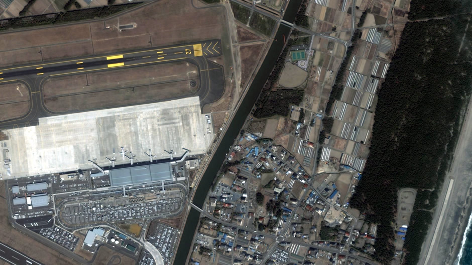
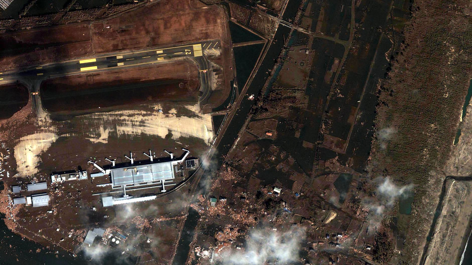
Sendai Airport
ⓒ Google, Digital Globe, GeoEye
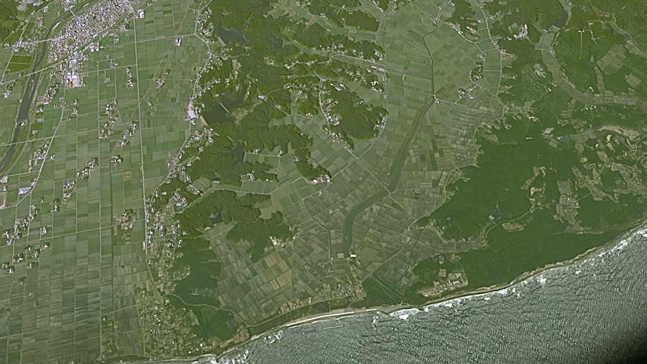
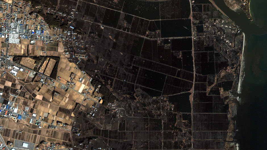
Arahama in Sendai
ⓒ Google, Digital Globe, GeoEye
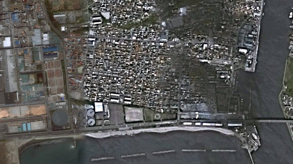
Fujitsuka in Sendai
ⓒ Google, Digital Globe, GeoEye
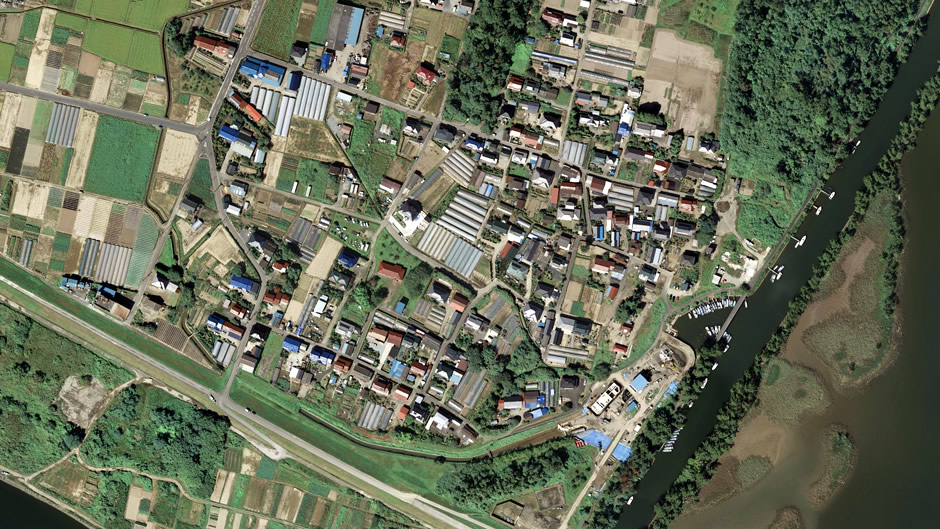
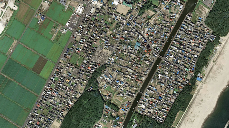
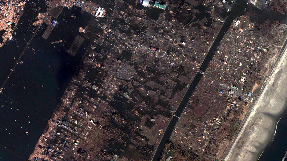
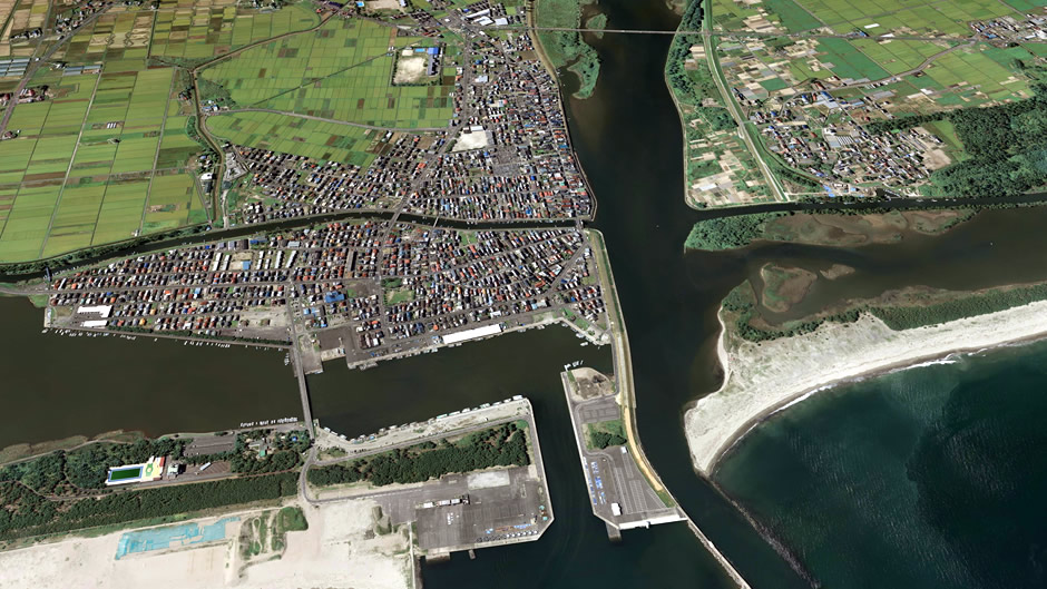
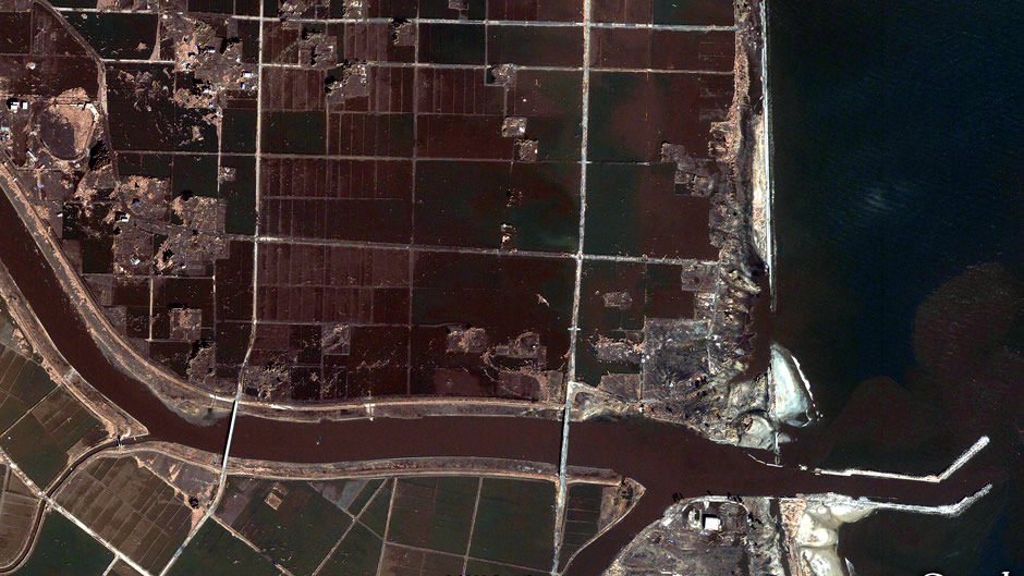
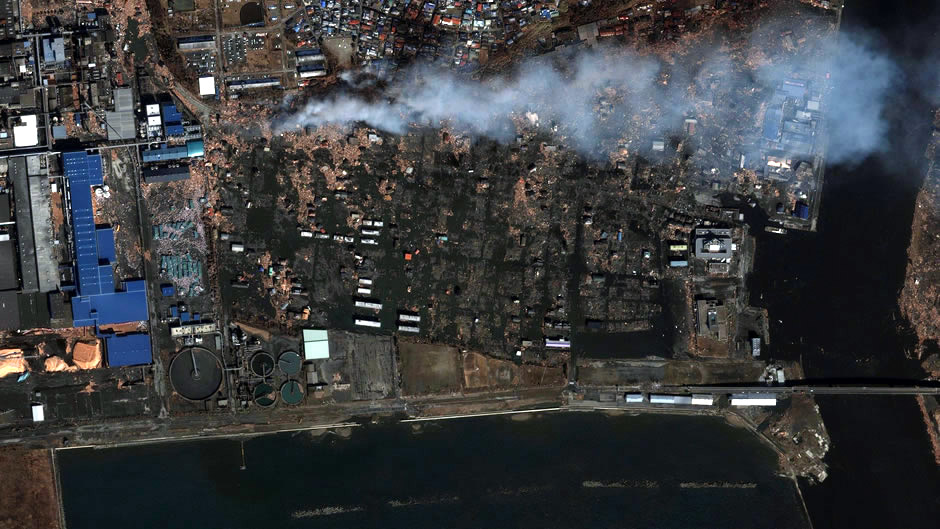
Yuriage in Natori
ⓒ Google, Digital Globe, GeoEye
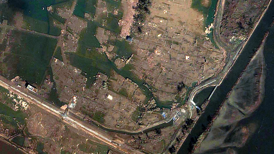
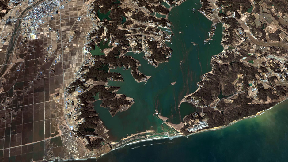
Yuriage in Natori (looking west)
ⓒ Google, Digital Globe, GeoEye

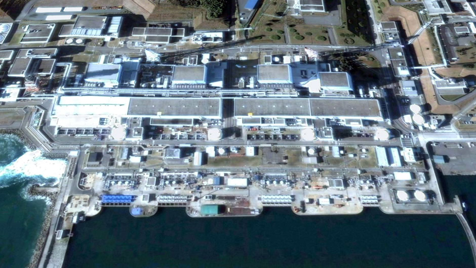
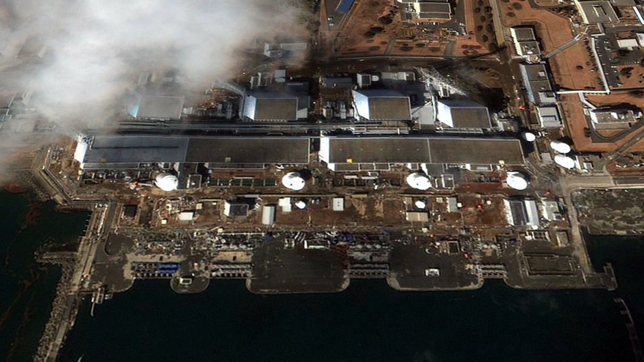
Fukushima nuclear plant
ⓒ Google, Digital Globe, GeoEye
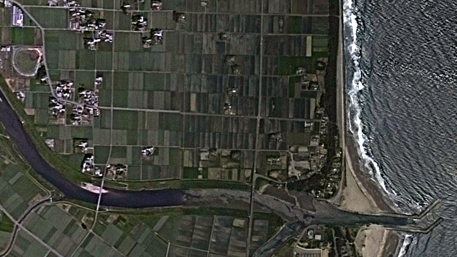
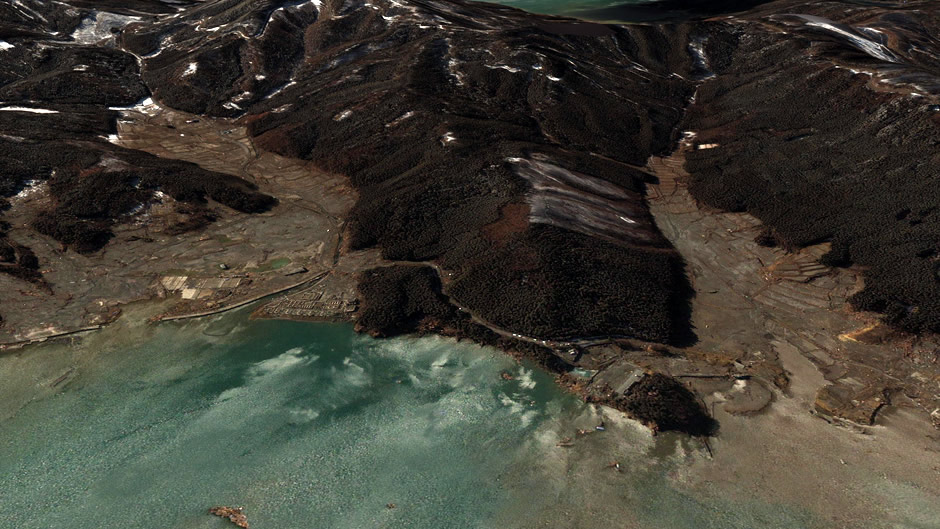
Kashimaku in Minamisoma
ⓒ Google, Cnes/Spot Image, GeoEye
Kashima in Minamisoma
ⓒ Google, Digital Globe, GeoEye
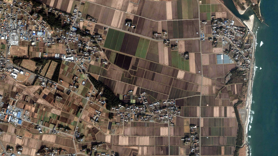
Haranomachi in Minamisoma
ⓒ Google, Digital Globe, GeoEye
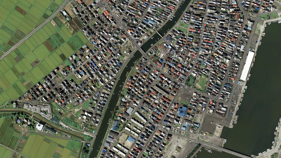
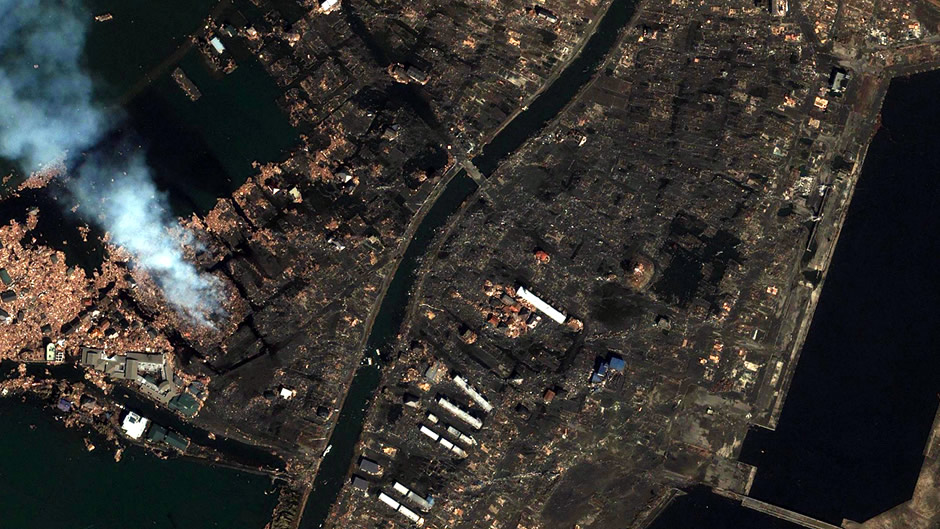
Ishinomaki in Miyagi
ⓒ Google, Cnes/Spot Image, DigitalGlobe, GeoEye
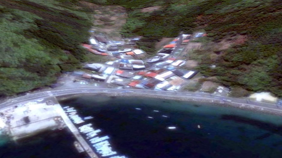
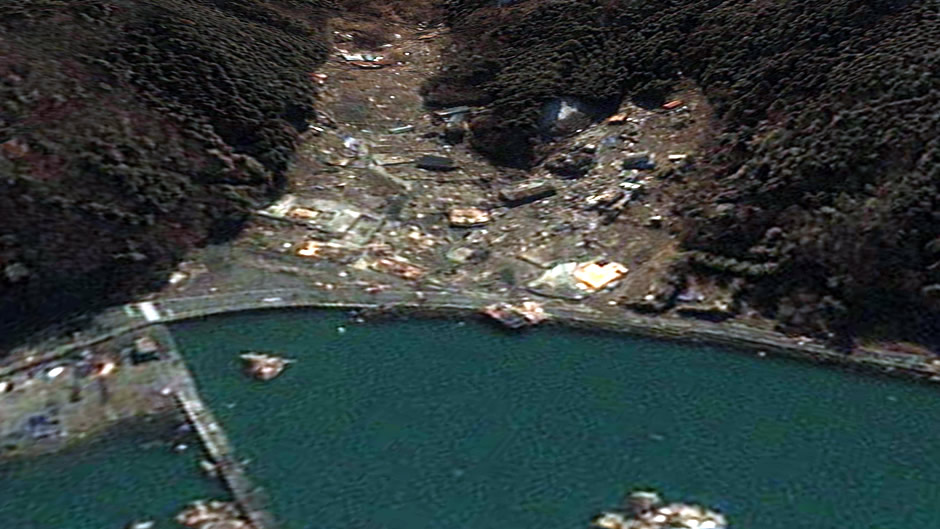
Iigohama in Miyagi (Oshika Peninsula)
ⓒ Google, Digital Globe, GeoEye
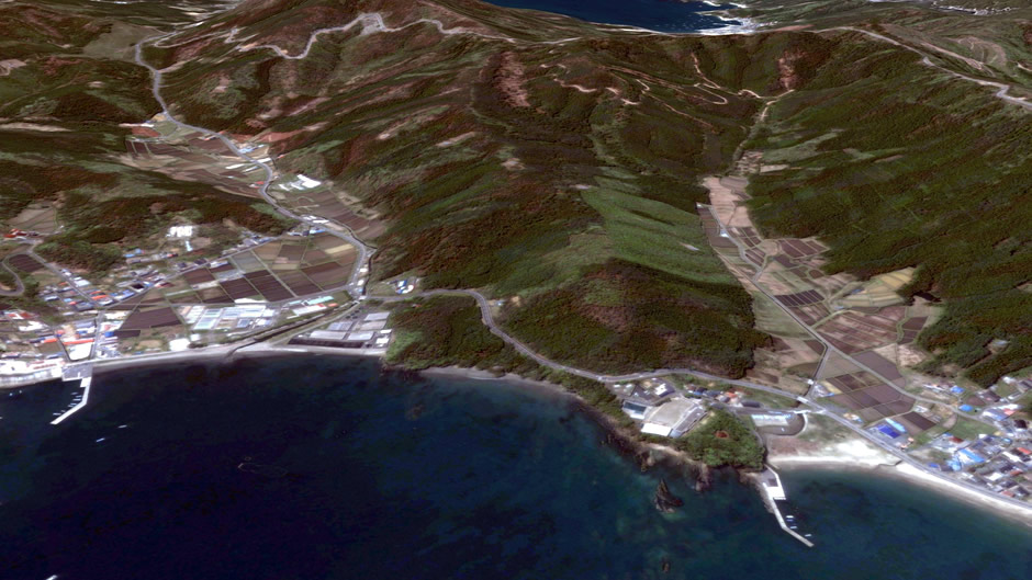
Yagawahama in Miyagi (Oshika Peninsula)
ⓒ Google, Digital Globe, GeoEye
[펌] 위성 사진으로 본 일본 지진